Three Important Factors When Hiring UAV (Drone) Services
In today’s fast-moving world of land development, it’s imperative that you have the right consultants with the right solutions. Particularly a firm who can adopt methodologies and integrate new technology into design solutions helping to overcome challenges, accelerate the pace of projects and drive down total development cost. Drone Services are one of the latest technological advancements and here’s what you need to know to hire with confidence.
We’ve all seen where technology is accelerating continuously. Over the years, surveying and engineering have seen the development and rapid implementation of advanced computational and measurement systems. Infrared distance measurements supplanted steel chains; GPS augmented the total station. Digital methods of collecting, transmitting, and storing data replaced the pencil, field book, and drafting tools. Each step required a learning curve; often as steep as it was costly.
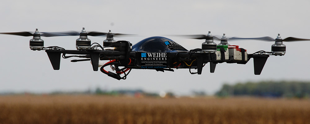
Today, the remote collection of accurate aerial photos, infrared photos, and Lidar data is just the latest wave of the future. Use of readily available, highly capable unmanned aerial vehicles (UAV’s) or drones have truly been a seismic shift in the way aerial imagery is collected.
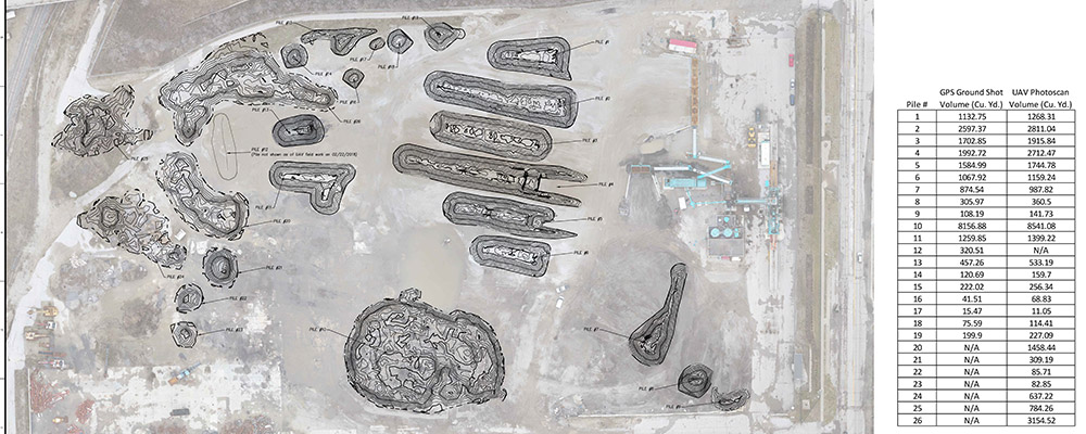
As always, the early adoption of new methods requires education and experimentation. However, the temptation to rely on results obtained with new technology must be resisted. Data sets collected by any one method should be tested and verified independently. Often this requires the use of the “replaced” technology. As surveyors, measurement theory and the processes involved are daily tasks. Redundant and independent measurements are consistent procedures to provide confidence in the data. Often newcomers to the mapping field will rely on technology to provide a visually outstanding package that can be lacking in integrity of data. If vertical or scale accuracy is required, the systematic measurement of representative samples of ground positions is the best insurance for the validation of collected information.
Of all the issues facing implementation of UAV technology, the regulatory environment is changing almost as fast as the technology. Following the FAA bulletins and web information services, tracking legislation as it evolves and is implemented, and continuing active participation in aviation professional organizations are mandatory to stay abreast of the latest evolution of the rules.
From a regulatory standpoint, strict attention must be paid to all statements emanating from the FAA regarding the latest rules, guidance, and information pertaining to UAV operation. New programs for obtaining access to controlled airspace are evolving almost daily. The responsible operator will be familiar with the 14 CFR Part 107 rules, the processes to obtain waivers to the rules, as well as the local ordinances applicable to small UAV operations. Individual airports have specific operational procedures that may be even more stringent or at variance with the FAA rules, particularly regarding notification on activity in their area of operation. Automated systems of notification and approvals are in preliminary trials, but not widely available yet. Knowing the contact points and procedures for obtaining operational approvals is key to timely, safe and legal flights.
Insurance is unavoidable in any endeavor in the current business climate. Many entities require proof of insurance prior to entry for any purpose. UAV flights are just the latest on the list. Liability, privacy, and hull insurance (equipment coverage) are three that should be in place for any consultant that wants to protect themselves, and by extension, their client.
In your conversations with drone or UAV service providers, listen to the answers to the critical questions of quality assurance, regulatory compliance and insurance coverages. If they are lacking in substance and clarity, it doesn’t matter how nice the imagery is, the liability may not be worth it.
To discuss how Weihe Engineers integrates the newest UAV technologies with the integrity of data provided by our Land Surveying department contact, our Vice President of Surveying, Brady Kuhn, P.S. at (800)452-6408 and Fly Weihe SM .